A Small Piece Of History In My Parent’s Front Yard

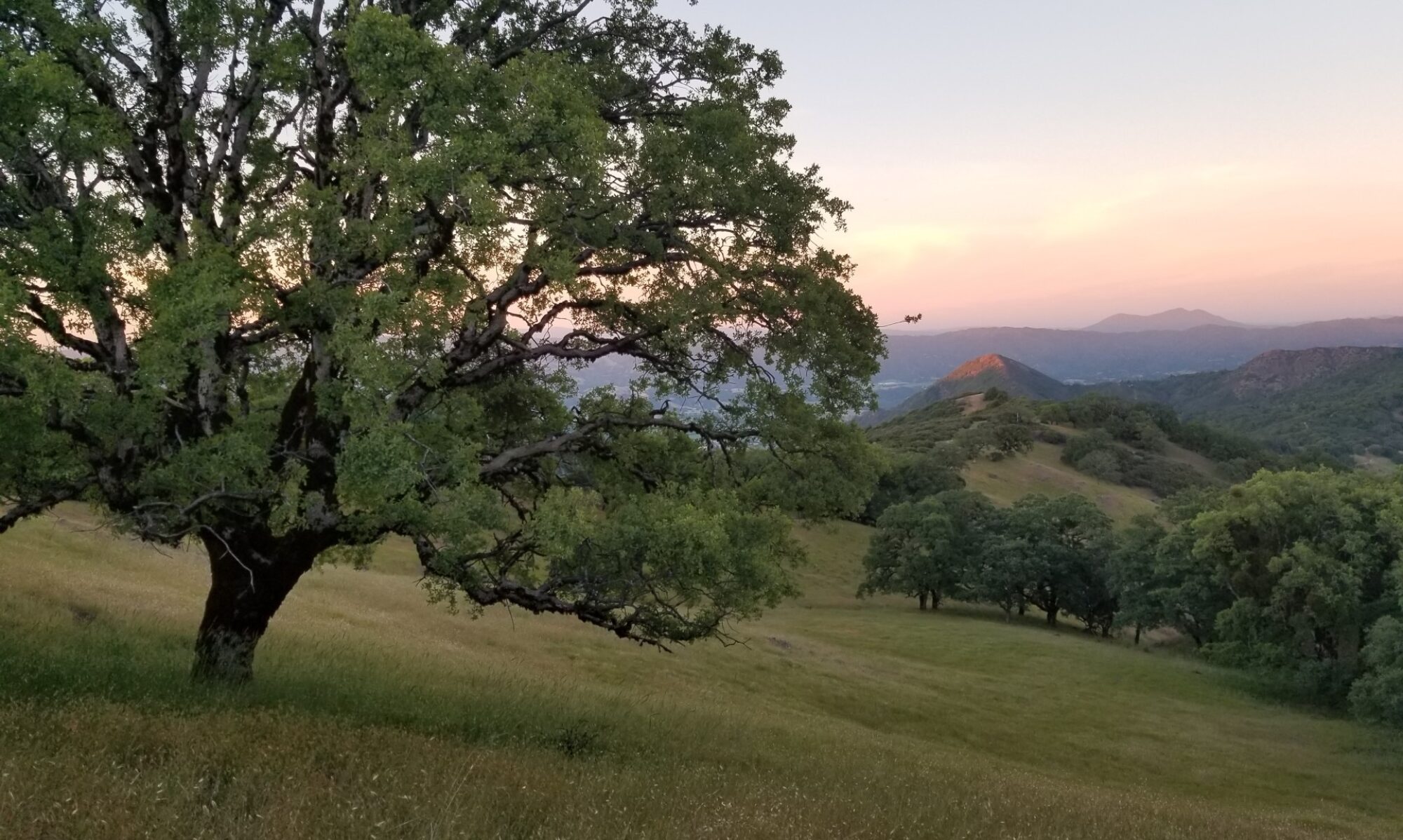
Last summer I spent a few weeks with my kids at my parents home.  They live on Lake Occoquan in Northern Virginia.  We had lots of fun paddling stand-up paddle boards and taking rides on the boat.

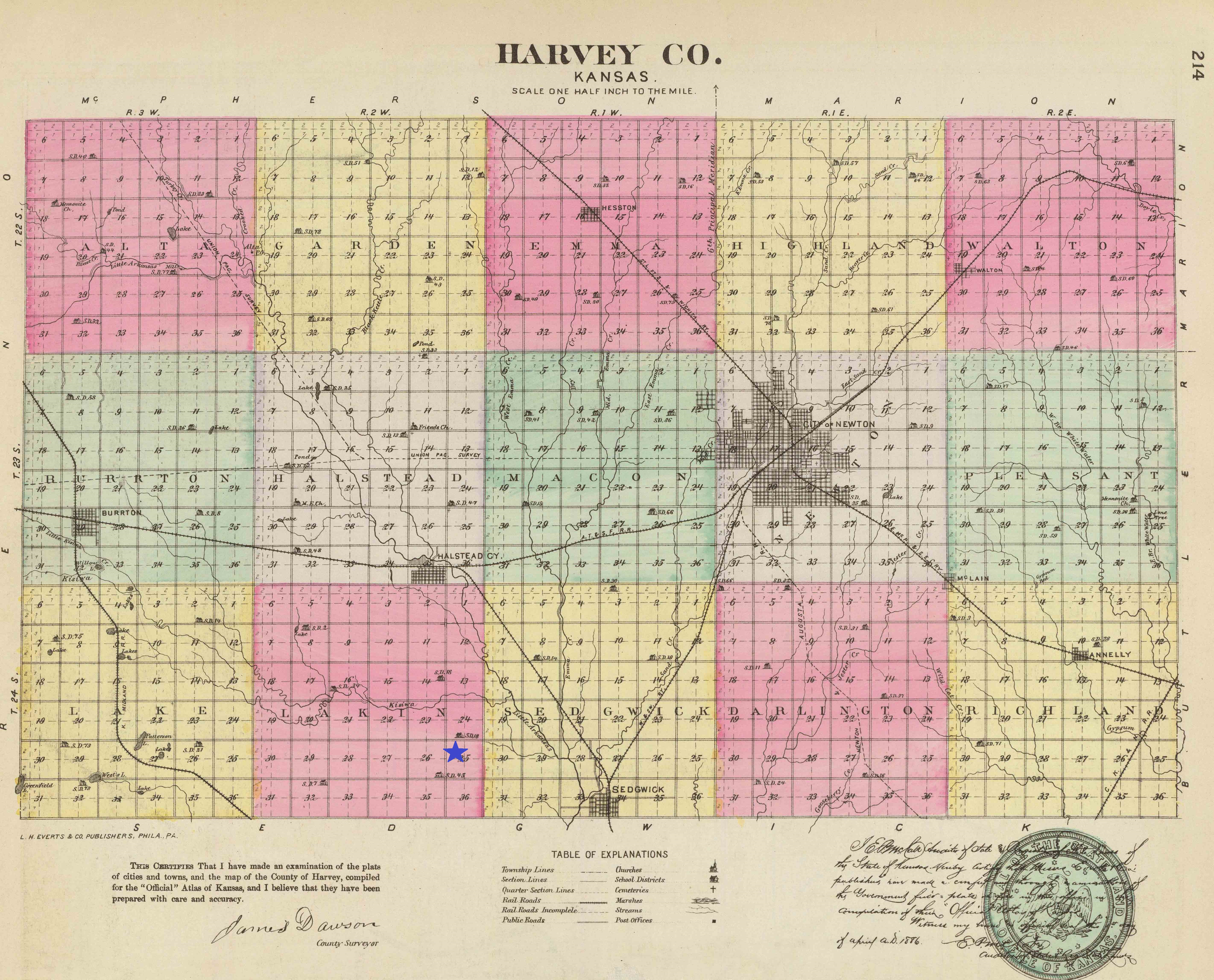
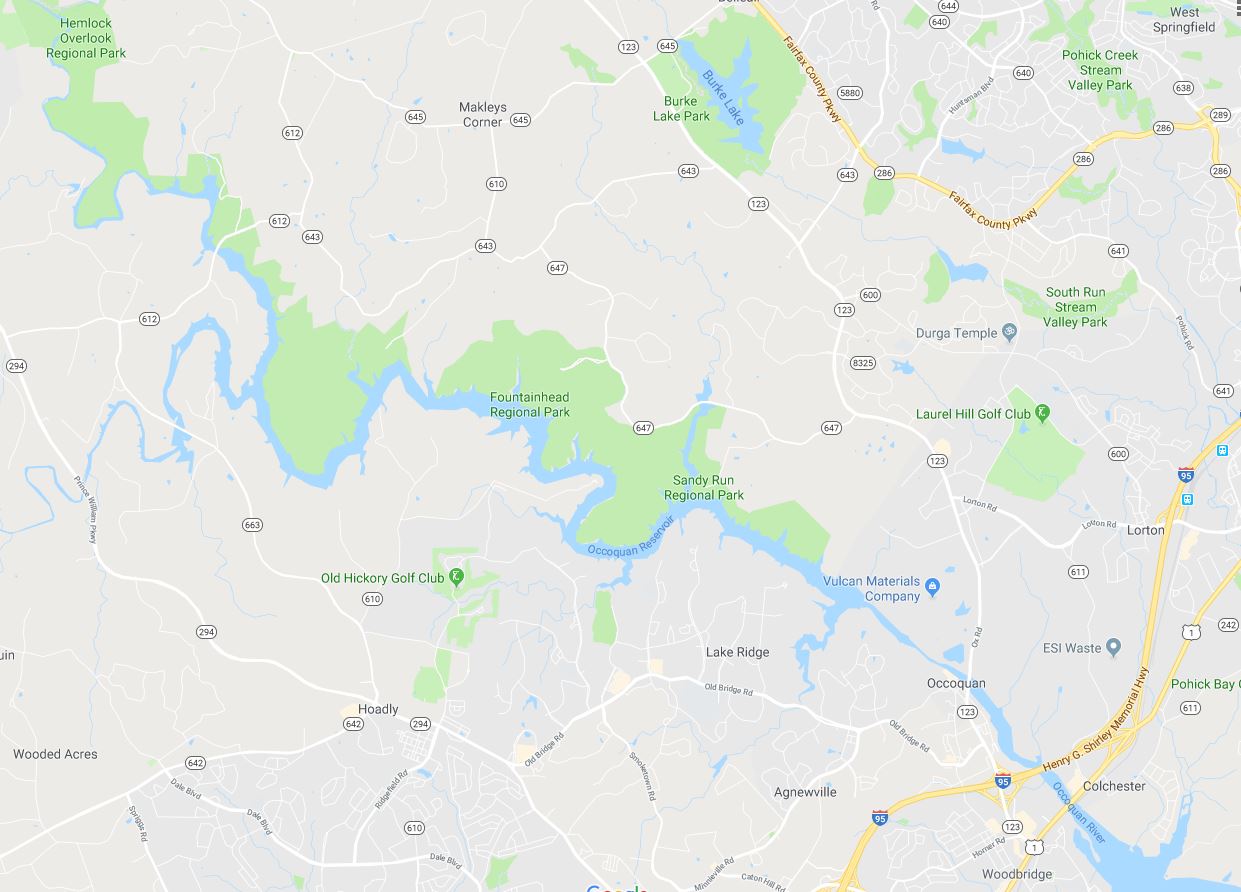
The Lake Occoquan Reservoir was formed in the 1950’s when 2 dams were built on the Occoquan River just east of the town of Occoquan, Virginia.   The reservoir holds 10 billions gallons of water and supplies Fairfax County and half of Prince William county with drinking water.

The Occoquan River begins where Bull Run and Broad Run meet.

Google Map of Lake Occoquan

Bull Run is well-known because of the Civil War.  The First and Second Battles of Bull Run occurred further up the waterway from where my parents live.  The battles were also  referred to as the First and Second Battles of Manassas by the Confederate forces.

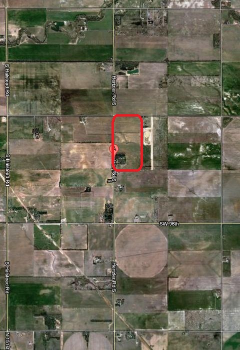
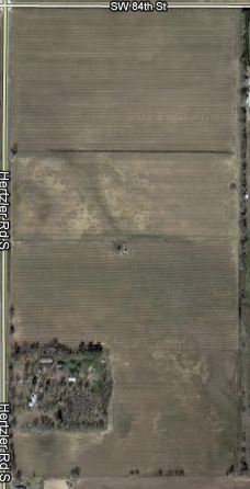
The area of land at the top of my parents driveway has a section of dirt road that runs across it with trees on either side.  I am going to be a little vague about the name of the road in order to protect my parent’s privacy.  The name of their street is the name of the river crossing (ford).

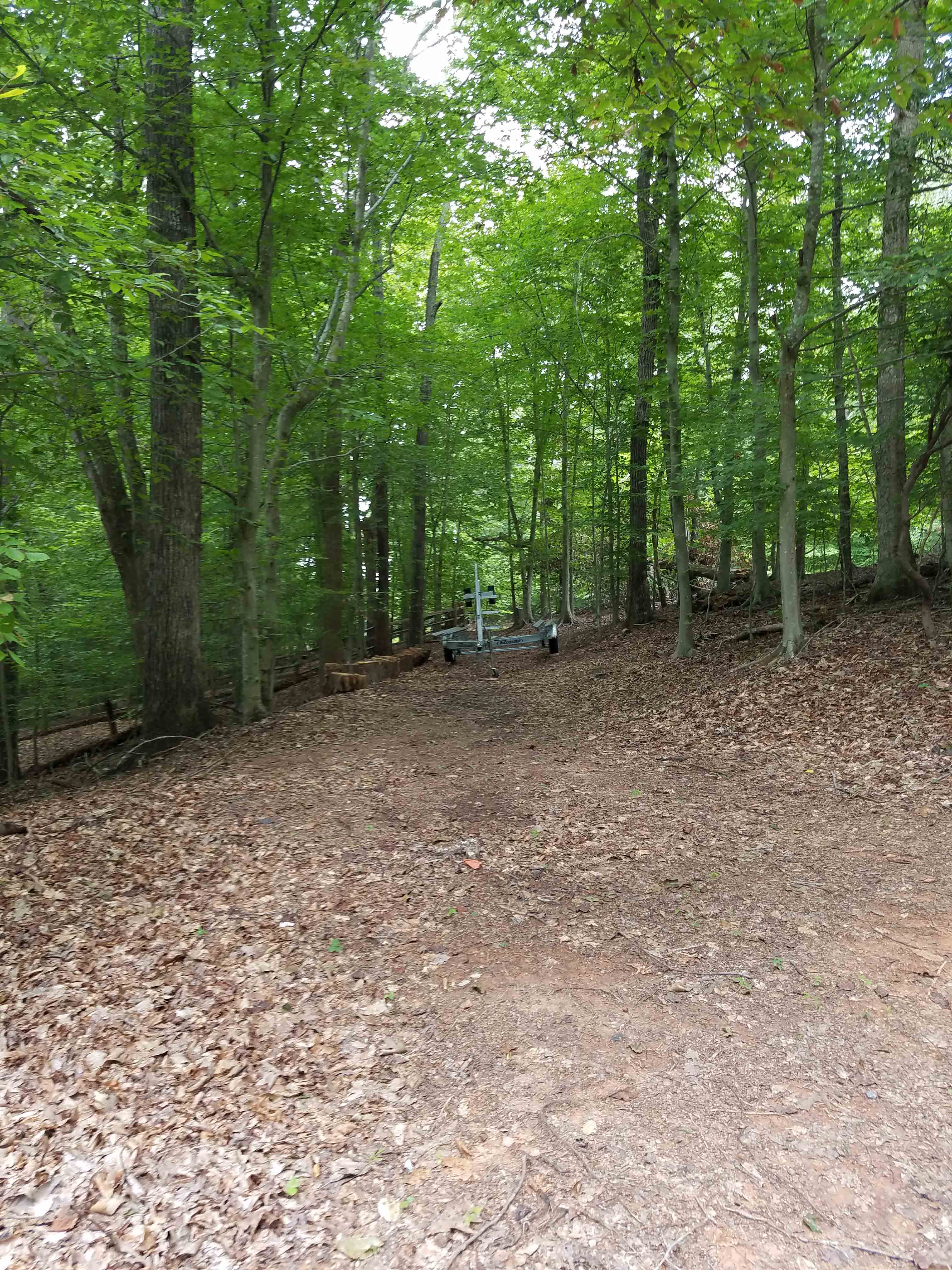
My father has spoken to his neighbors and found out this small section of road was what was left of the old road from the 1800’s.  It goes across my parents land and then is under the current paved road for a while.  The dirt road then reappears on the neighbor’s land heading down to the water.

A neighbor informed my dad this road was one of only a few safe places people could cross Bull Run in the 1800’s.  Some people in the neighborhood have found Civil War rifle bullets.  The story is there were skirmishes at the river crossing (ford) with the Union and Confederates firing across the river at each other.

This past summer we made a cool discovery while out paddling on the river.  My dad, kids, and I had paddled up the river a little bit into a more shallow area that is off the main river.  My kids have named this spot Pirate’s Cove.  We paddle over there to search for pirates and treasure.

The trees hang over the lake in this cove.  I sat down on my paddle board for a minute to help kid #2.  From this vantage point I could see under the branches. I realized I could see a cleared area.  I moved my board to a different position in the cove and realized this was the other side of the dirt road.  After wagons went across my parents land and Bull Run, they would have traveled back uphill at this point.

After returning from our paddle adventure, I began googling for any information regarding the fords on Bull Run.  I was excited to find a Civil War map that has been digitized and available on the Library of Congress website.

Library of Congress. Fords of Occoquan and Bull Run.

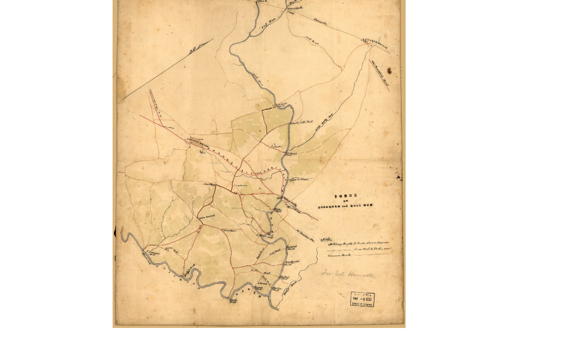
Sure enough, the crossing close to my parents house is on the map.  According to this map, the ford by my parents house was a secondary route and not as well-traveled as the main road fords.  This does not surprise me.  The next ford up river is still the location of a main road today.  In fact, as you drive across the current concrete bridge you can see remains of the old stone bridge that once was the road.

The most likely scenario is that the ford near my parent’s house was in a very shallow location.  This would have allowed wagons to cross without danger.

I also located a 1901 map of Prince William County at the Library of Congress.  The ford near my parents house was no longer on the map.

Next summer we will return for another long visit.  I hope to find time to explore the road up the east side of the river.  I also plan to visit more of the local historical societies to see if I can find more information about the neighborhood and fords.


Researching For My Day Of Research

In a few weeks I am flying to the East Coast to meet my new nephew.  I am so excited to finally meet the little man in person!  He arrived a few weeks early so I have been obsessing over him through the photos my sister has been sending.  While I love the little man, I plan on disappearing one day of our trip to get some genealogy research done.

This year I am jumping in with the big boys and girls.  I am going to spend my day researching at the National Archives.

Photo from www.archives.gov

I spent a couple of hours last weekend getting ready for my trip.  First item on my list was to learn more about visiting the National Archives and Records Administration (NARA). At the NARA website one of the first tabs you see invites you to learn more about planning a visit to one of their locations.  I clicked on the District of Columbia location and found address, hours, transportation, food information, etc.  I also visited the webpage for Researchers.  This was important because it outlined the procedures, types of records, and orientation information.  Also included on the page was a video explaining what to expect when you research at the National Archives.

Now that I know how to behave myself, I turned my genealogy powers to what exactly I wanted to learn more about.  I am currently transcribing a series of deed records for my ancestor Moses Mitchell.  He bought land from one of his brothers in Jackson County, Kansas in November 1858.  This trip will be a great time to research how the family obtained the land in Kansas.

After consulting the NARA website, I know that I will need specific information ahead of time to pull the land entry case file I am looking for.  I am using the Bureau of Land Management, General Land Office Records website (BLM-GLO) to find the original land patents to identify the state, land office, certificate number and type of entry for each transaction.  I have started an excel file to keep information organized by family and state.  I will print out a copy of my excel sheet to take to NARA and use it to fill out my pull slips.  Here is an example of what it looks like for the Mitchells in Kansas:

NARA land file

As I complete my research to do my research I am remembering the day Joshua Taylor spoke at the Spring Seminar at the San Mateo Genealogical Society.  I distinctly remember when he said you generally need to put in an hour of work ahead of time for each hour you plan to spend at a research facility.  I am getting my hours in so that my trip will hopefully be successful.  Wish me luck!

Those Places Thursday – Jefferson County Register of Deeds

I have been talking about my trip to Kansas the last couple of weeks.  I will have a lot of upcoming posts with information I found on my trip.  I want to make sure I acknowledge the locations where I found all of my goodies.

The focus today is the Jefferson County Register of Deeds.  I decided to stop here on the morning of our last day before driving to Atchison for some shopping with my mom.  I knew I only had a few hours to research here and planned my attack the night before.

Jefferson Courthouse

The Jefferson County Courthouse is located in Oskaloosa, Kansas.  It sits in the center of the town with shops surrounding the square.  The women who work in the Register of Deeds office were incredible.  Upon arriving, I explained that I was looking for deeds related to Moses Mitchell when he moved to the area.  I was shown the Grantee Index books and set loose.  I was able to locate 3 deeds that related to my ancestor.

The office does not allow photos to be taken.  The good news is that every deed in the office has been digitized so I just had to ask for a printed copy.  The print outs were definitely a better quality than I could have gotten on the copy machine.

Me and my Mom looking at Deed Books.  The only photo allowed.
Me and my Mom looking at Deed Books. The only photo allowed.

I also was able to find a descriptive map of the area that shows exactly where my ancestor’s land was located.  The woman at the front desk made a copy for me on 2 large sheets of paper so that I did not need a magnifying glass when I got home.

My last great find was shelves that had information from the local genealogy society.  Along with marriages and school census information, there was 2 large binders of old genealogy society publications that also had an index.  I made a couple of great finds in those.

I cannot say enough about how helpful and kind the women who worked in the Register of Deeds office were.  Hopefully you have some ancestors from Jefferson County, Kansas so you can use this great resource!

Those Places Thursday – Bender Home in Lakin Township, Harvey, Kansas

Lakin Township is where my great-great-great-grandfather John Bender farmed in the late 1800’s.  I know from his obituary that he arrived in Lakin Township in 1876.  He and his wife Matilda brought with them 4 sons and a daughter.  After arriving in the area they had 2 more boys and another girl.

On my research trip to Kansas in October 2010, I had the chance to visit the Harvey County Historical Society in Newton, Kansas.  One of the many great finds that afternoon was the Harvey County Historical Plat Maps 1882.  My ancestor John Bender was listed in the index.

Bender Land Index


Here is an overview map Harvey County, Kansas.  I have added a blue star to section 25 in Lakin Township.  This is the area where John Bender resided as listed in the index.

Harvey County Kansas


I then looked at the Plat Map for Lakin Township and looked in section 25.

Bender Plat map


This was so exciting!  I had located where the family lived in the county.  Now my goal was to translate this plat map to a current map.  First, I found a historical map of Harvey County at the David Rumsey Historical Map Collection.  The map I found was perfect.  It laid out the sections, towns, and railroad lines in the county.  I added the image as an overlay to Google Earth.  After lining up the historical image with all of the landmarks, I was able to identify where the 80 acres is today – 9169 Hertzler Road South, Sedgwick, Kansas.

Bender today

Here is the crazy part  – My Mom and I drove right past this house!!  We were heading north from the cemetery where the Benders are buried to the town of Halstead.  This is the street we traveled to get there.  We drove by without even knowing it!

I have gone a step further and checked the Bureau of Land Management Records website.  Sure enough, I have found a Timber Culture Patent for John Bender for 80 acres.  I was not too sure what a Timber Culture Patent is so it was time to research that.  According to Wikipedia, it was a follow-up to the Homestead Act that allowed homesteaders to gain 160 acres of land as long as a quarter of the land was planted with trees.

Here is a closeup of the property I have identified.  You notice that the area in the southwest corner is covered in trees.  When using the street view on Google maps, you can see the house in the trees.  This is the same area marked with a house on the Plat Map from 1882.  I believe that my 3rd great-grandfather planted those trees as part of his patent requirements.

Hertzler Road


What an adventure!  I cannot wait to do this same exercise for the land that Charles Bradley and his family lived on in the same county!